Yap, Chuuk, Pohnpei, Kosrae
The FSM is an independent nation encompassing over 600 high islands and atolls comprising 270 square miles and spanning 1,600 miles east to west across the western Pacific Ocean. The islands are politically organized among four states associated with the four main island groups of Yap, Chuuk, Pohnpei, and Kosrae.
Human Habitation and Biodiversity
The region was settled by people several thousand years ago and evidence indicates the islands supported much higher population densities than at present with sophisticated agroforestry and fisheries management systems, many of which are still practiced at smaller scales today. The region is culturally and linguistically diverse and considered a biodiversity hotspot for its both marine and terrestrial ecosystems.


Human-caused Fire and Ecological Effects
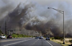
Fire-prone savannas occupy each of the main high islands in the FSM to varying extents and are derived from a long history of intentional burning by people. These savannas consist largely of native grasses, ferns, and shrubs and are interspersed among tropical forests and agroforests, forming complex, mosaic landscapes.
Seasonal and Climate Variability
Yap, the westernmost high island in the FSM, has the largest expanses of savanna vegetation and fires occur annually during the dry season from January to May. Savanna extent declines along with rainfall seasonality moving eastward towards Chuuk, Pohnpei and Kosrae, but extensive fires have been reported from these moister regions during extreme drought conditions such as occur during El Niño events.

 Julian Dendy")
Yap Wildfires
The U.S. Forest Service's Pacific Island Research center's Julian Dendy mapped the extent of wildfires from 2016 - 2022.

Recent Resources for the Western Pacific
In this joint webinar hosted by the Pacific Fire Exchange and the Pacific Regional Invasive Species Climate Change, we tackle the climate crisis in Hawai`i and how this affects the risk of wildfire as well as the impacts to people and the archipelago’s unique resources.

In this Pacific Fire Exchange talk story Q&A session, we speak with Dr. Clay Trauernicht and Dr. Alyssa Anderson, University of Hawai`i at Mānoa about wildfire in Hawai`i in the context of Hawaiian language newspapers as well as the historical landscape changes of the 20th century.
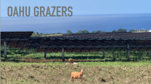
In this Pacific Fire Exchange talk story Q&A session, we round up the latest research, past and present for managers and landowners wanting to understand more about how our four-legged friends (goats, sheep, cows, etc.) if managed properly can help reduce blazing and wildland fire. This month’s science share out and conversation was with Dr. Clay Trauernicht, University of Hawai`i at Mānoa Ecosystems and Fire Specialist; Raia Olsen of O‘ahu Grazers and Dr. Elliott Parsons, formerly with the Department of Land and Natural Resources. They presented the how-tos on hiring island professional grazers and lessons learned for contract grazing.