Pacific Island Wildfire Data
Hawai‘i
NOTE ON DATA USE AND DISTRIBUTION: We actively encourage use of this data set for scientific purposes and planning by communities, natural resource managers, and emergency response agencies. Users are prohibited from any commercial, non-free resale, or redistribution without explicit written permission from Dr. Clay Trauernicht at [email protected].
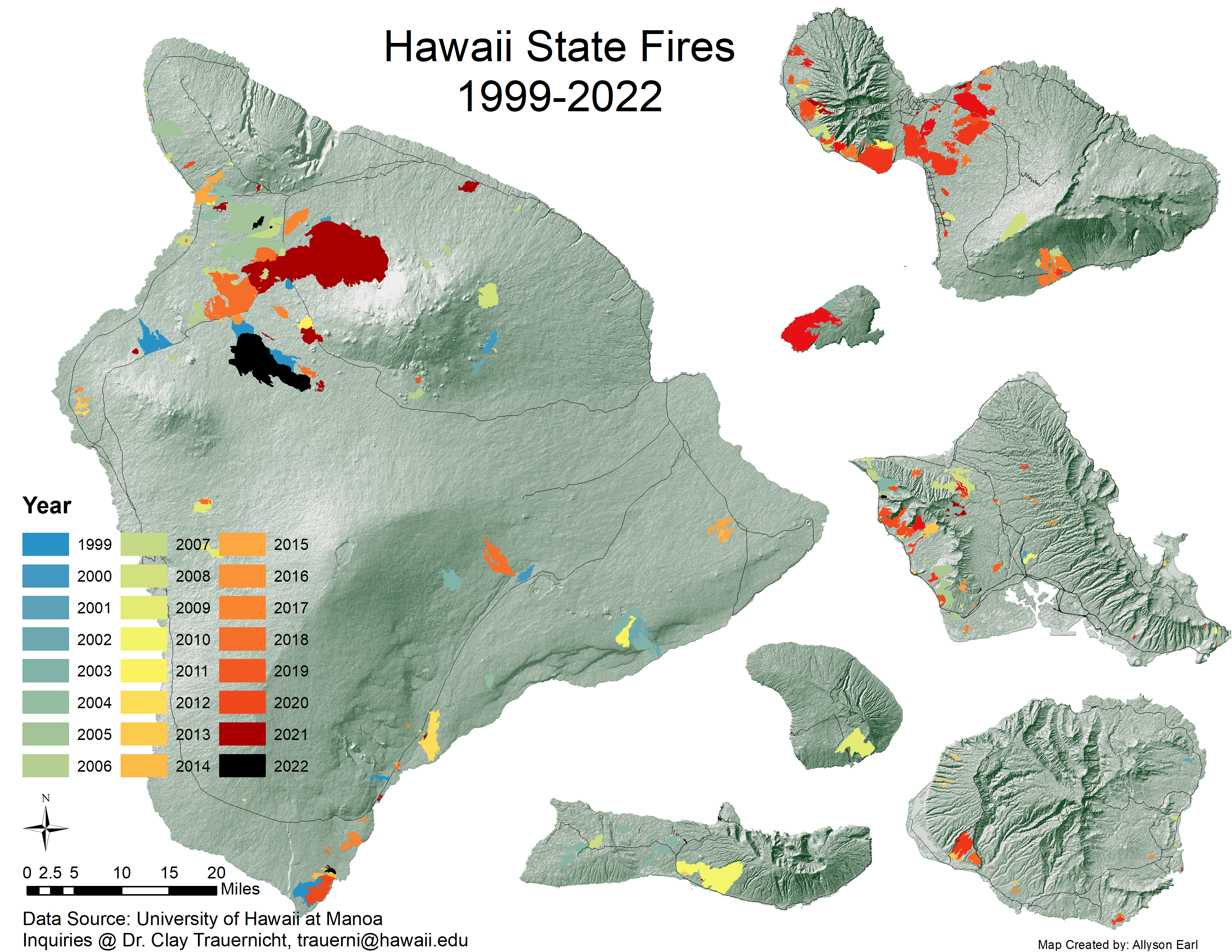
1. Large Fire Perimeter Data for Hawai'i (1999 - current):
This data set contains polygons of wildland fire perimeters for the main Hawaiian Islands from 1999 to 2022. It compiles prior mapping efforts by different organizations with fires mapped from 2012 onwards by Dr. Clay Trauernicht ([email protected]) in the Department of Natural Resources and Environmental Management (NREM) at the University of Hawai'i at Mānoa. The data tracks and maps all fires greater than or equal to 20 hectares (50 acres), but some smaller fires are be included. READ MORE HERE >>
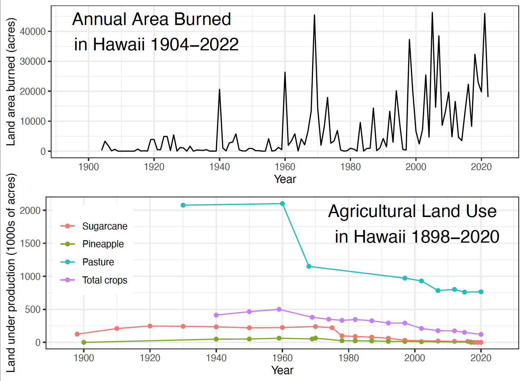
2. Hawai‘i Annual Area Burned (1904 - current):
These data provide the available statewide record for annual area burned spanning 1904–2022 (updated annually) using combined data sets from Schmitt (1977) compiled from State and Territorial Forestry reports, online Hawai‘i Department of Land and Natural Resources Division of Forestry and Wildlife (DOFAW) reports, and the Hawai‘i Wildfire Management Organization (HWMO; hawaiiwildfire.org). READ MORE HERE >>
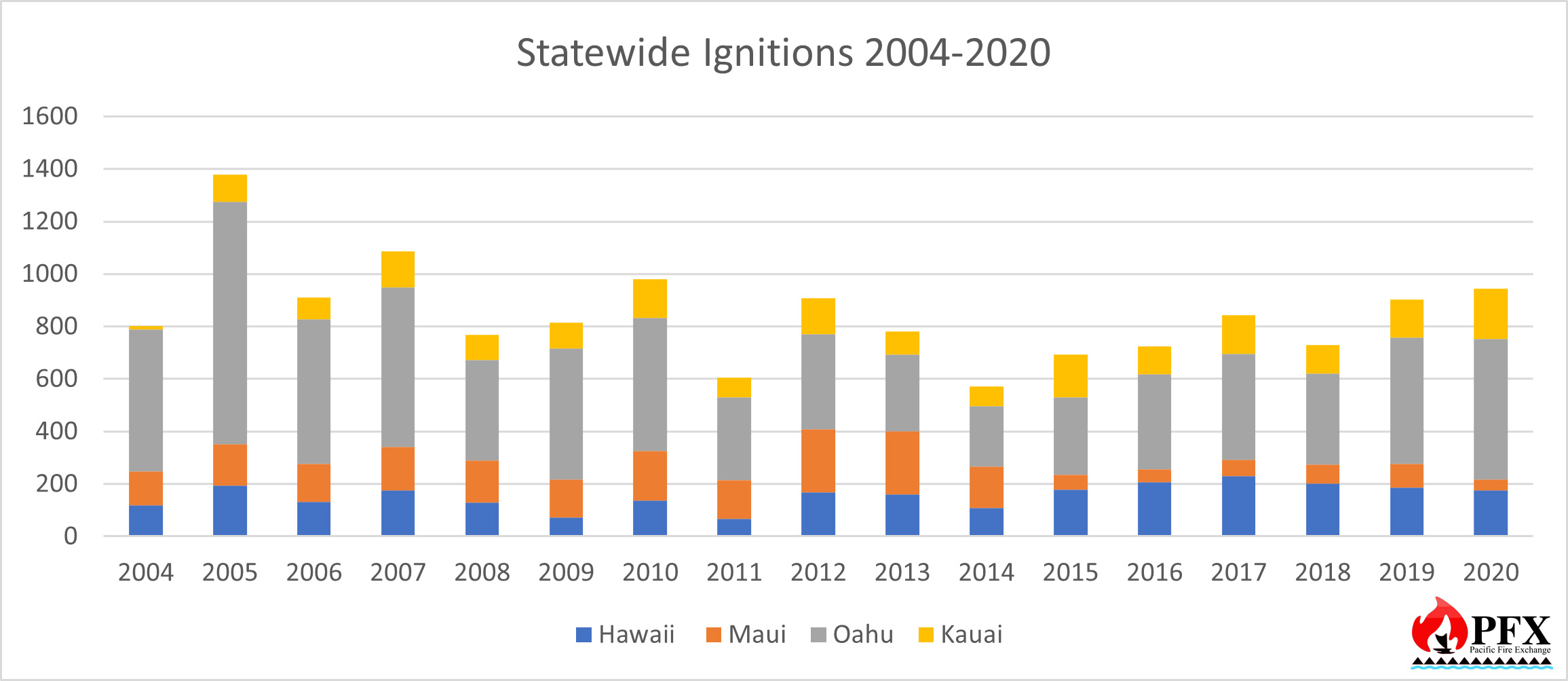
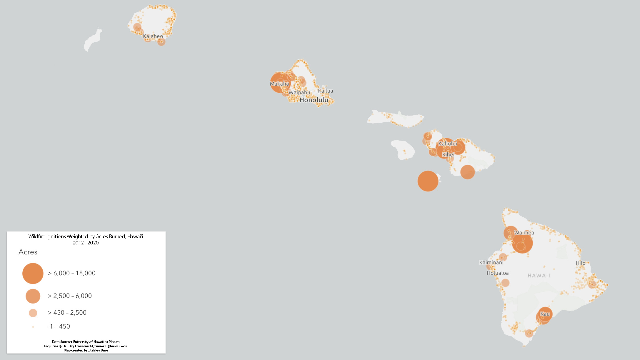
3. Hawai‘i Wildfire Ignition Points (2005 - 2020):
The data set provides point-based locations of all wildfires recorded for the main Hawaiian Islands (except Niihau and Kahoolawe) for 2005 through 2020. This data set combines fire record data from Hawaii’s four county fire departments (Hawaii County, Maui County, Kauai County, and Honolulu City and County), the Hawaii Department of Land and Natural Resources Division of Forestry and Wildlife, and the National Park Service. The data were collected from the agencies through a collaborative effort between Hawaii Wildfire Management Organization (HWMO; hawaiiwildfire.org) and Dr. Clay Trauernicht at the University of Hawaii at Manoa (UH Manoa). This current data set updates an effort led by HWMO in 2013 and all records from 2012 through 2020 were quality controlled by UH Manoa. READ MORE HERE >>
Western Pacific
1. U.S. Forest Service - Western Micronesia wildfires (2016+) (2nd Edition):
This data publication contains vector polygon spatial data showing burn areas from wildfires in 2016-2023 on Guam, Yap State (Federated States of Micronesia-FSM), and the Commonwealth of Northern Marianas Islands-CNMI (Saipan, Tinian and Rota Islands). Burn areas from wildfire in 2015 are also provided for Guam.
2. U.S. Forest Service - Babeldaob Island, Palau wildfires (2012+) (2nd Edition):
This data publication contains wildfire locations as well as areas of repeated wildfires on Babeldaob Island, Palau. These data were digitized from a variety of sources: handheld global positioning system (GPS) fire perimeter mapping, aerial photo fire perimeter mapping, and satellite image fire perimeter mapping. In addition to 1) wildfire locations (2012-2023) and 2) the areas of repeated wildfires (2012-2021), also included for Babeldaob Island (dated 2021 unless otherwise noted) are: 3) streams composed from topographic maps, 4) roads (obtained from Palau Automated Land and Resource Information Service (PALARIS) and updated with 2015 imagery), 5) locations of terrestrial protected areas, 6) mangrove vegetation around the island, 7) Babeldaob Island state boundaries, and 8) Babeldaob coastline.


