In "Partner Perspectives" we get to know the diverse people, roles, and views of wildfire management in the Pacific. Orlando Smith kindly spent some time with us discussing his experience in creating useful maps for wildfire management.
Name: Orlando Smith
Role: Geographic Information Systems (GIS) Specialist
Organization: Hawaii Wildfire Management Organization (HWMO)
Pacific Fire Exchange (PFX): Describe your role at the Hawaii Wildfire.
Orlando (OS): I’m presently Hawaii Wildfire’s Geographic Information Systems (GIS) Specialist. Initially - twelve years ago - I was a private contractor for HWMO and now I’m a part-time employee. My tasks revolve around mapping and database management. I manage and analyze data for things like wildfire mitigation measures, and then present that information in map form.
“...it was the start of the conservation side of my GIS applications - which is the part of my career I value the most. The work at Hawaii Wildfire is meaningful and useful...”
PFX: What sparked your interest in wildfire?
OS: Before contracting with HWMO I was interested in land use and planning, and I was doing planning and development-related GIS work. Hawaii Wildfire secured a grant for a wildfire resource mapping project and the original contractor dropped the project. I was fresh out of college and it was a fascinating new application. The project appealed to me in part because someone else had failed at it and I thought “I can do it - nothing is ever impossible.” It might not have been financially prosperous for me but it was the start of the conservation side of my GIS applications - which is the part of my career I value the most. The work at Hawaii Wildfire is meaningful and useful, and that project really introduced me to this organization.
PFX: Describe a couple of your wildfire-related mapping projects.
OS: My first Hawaii Wildfire GIS project was on wildfire resources on the Big Island. We compiled and mapped information that firefighting personnel would find useful in the event of a wildfire. We collected data on water features and access - like who to contact at what phone number for a gate key, and tank fitting sizes for water features. We met with all three shifts at each of the 19 or 20 fire stations on the Big Island and asked them to help us collect GPS data. Some stations were very interested in the GPS units and used them to gather very useful, comprehensive, quality data. For our final product we had large printed maps for each station that included the data gathered within each station’s region.
For another challenging and fascinating project we addressed the runoff and erosion that occurs with de-vegetated burned areas. We used GIS runoff calculating capabilities to model a particular watershed and propose measures for reducing the sediment transport. For example, creating vegetated buffers along the streambanks dramatically reduces the amount of runoff entering the stream. We were able to estimate the impact of different mitigation measures, and then some projects actually instituted some of our proposed measures based on the model’s predictions.
“Sometimes we can convene as scientists and share papers to learn from each other, but sometimes festive informal settings engage people in ways where a normal symposium may not.”
PFX: What unanswered questions do you have about wildfire?
OS: Different resource managers, scientists and stakeholders are starting to share information in a way that brings the functionality of mitigation measures to a higher level. And that’s what it’s all about for me. The questions that I have are “How can we engage each other at a higher level?”, “How can we encourage better, more frequent, substantive communication?” Sometimes we can convene as scientists and share papers to learn from each other, but sometimes festive informal settings engage people in ways where a normal symposium may not. Maybe we need to drink more wine together, go on retreats, or make more movies - I don’t know exactly what. But we need to try more non-conventional approaches to bring stakeholders together and address wildfire issues comprehensively.

ORLANDO ON STAGE
PFX: Favorite way to spend the weekend?
OS: I like to take walking adventures with my girlfriend. We always take this wild-long walk to the beach park near our house on weekend mornings. We also go on walks on the coast, in the mountains, and different little towns on the Islands.
Music is also a hobby of mine. I create digital music - hip-hop with a little world influence, crazy beats with strange universal-influenced melodic stuff. I also play in three different bands as a drummer - a Hawaiian jazz trio, an organic original reggae group, and a pop-island reggae project.
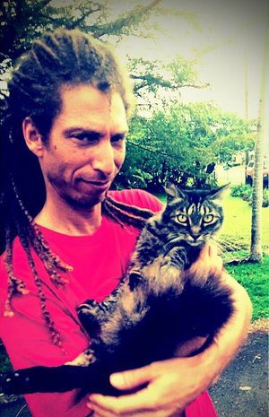
ORLANDO WITH HIS CAT BENTLEY
PFX: Share something most people don’t know about you.
OS: People don’t know I’m a super cat person. I like to walk around with my cat in my arms. The longest I’ve ever walked with my cat in my arms is probably an hour. I was just doing everything I had to do with one hand, going about my day, holding my cat. Bentley’s a really tame cat. He goes to sleep in my arms. I wish I could bring him to work!