Kaua‘i
Near the geographic center of Kauaʻi is one of the wettest known places on earth, Mount Waiʻaleʻale. Despite this, wildfires can and do occur on the island. Steep slopes, rough terrain, difficult access, a large percentage of highly ignitable invasive grasses, and numerous threatened and endangered native species characterize the Kauaʻi landscape.
Ignitions occur regularly in the inhabited areas of the island, mostly near the coasts, where the landscape is dominated by current and former agricultural lands as well as grass and brush.


Kauaʻi is among the oldest high Hawaiian Islands and has been shaped by significant erosion, creating its dramatic landscape of valleys. Some of the steepest and least accessible areas include the North Shore to the West side, which also correspond strongly with the highest concentration of threatened and endangered species. This creates a challenging environment for reaching and containing fires when they occur, and presents a risk to the resident endangered species. >> READ MORE
After fires burn through an area of native vegetation in Hawaiʻi, the rebounding vegetation is generally dominated by fast growing non-native grasses and shrubs. Not only does this negatively impact biodiversity, but this can also contribute to erosion and the risk of landslides especially on the steep slopes of Kauaʻi.
The biggest large fires have historically occurred on the lee slope of the eastern flank of Waimea valley. This presents a concerning fire risk for the drought-prone community of Kekaha.
Kauaʻi is known for its high rainfall, but annual rainfall is not always a good indicator for risk. Particularly wet periods over a rainy season can, counterintuitively, significantly elevate hazard levels. Increased precipitation may lead to a surplus of vegetation growth, becoming potential fuel during subsequent drier periods, thereby elevating the risk of large wildfires. Given the changing wind and rainfall patterns arising from climate change, this may lead to increased risk for Kauaʻi.

Plans & Images


Recent Resources For Hawai‘i
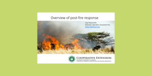
A slide presentation overview by Dr. Clay Trauernicht of best practices for assessing and mitigating after-fire impacts to the environment.
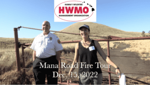
On December 13 -15, 2022 the Hawaiʻi Wildfire Management Organization and wildland fire managers from the western U.S. and Hawaiʻi’s county, state, and federal fire agencies met on Hawai‘i Island. Hawai‘i representatives were able to bring mainland partners up to speed on Hawai‘i’s fire ecology, our mitigation challenges, our collaborative programs to educate and mitigate, and our post-fire stabilization needs and recovery goals via a field tour of one of Hawai‘i’s largest fires in recent history.
New climate projections for Hawai‘i are based on historical rainfall, and future climate scenarios, such as the footprint of highest fire risk is expected to increase in extent and move upwards in elevation while fire risk may decrease in the driest low elevation areas. This fact sheet summarizes the latest climate change research as it relates to wildfire.