O‘ahu
As the most populated island in Hawaiʻi, Oʻahu experiences a significantly higher number of wildfire ignitions than other islands. This elevated ignition rate, coupled with densely populated communities in close proximity to fire-prone shrublands and grasslands, presents a potentially hazardous situation for thousands of residents.


The steep slopes of the Koʻolaupoko and Koʻolauloa regions on the windward side intercept a substantial portion of the moisture from prevailing northeast trade winds, resulting in the distinctive wet windward side and drier lee areas. The most vulnerable areas on the windward side of the island are around Kāneʻohe Bay, where ignitions, winds, and subdivisions bordered by patchy grasslands increase risk, and near drier Kahuku to the north.
Along the leeward south shore from Pearl City to Hawaiʻi Kai is the island's most densely developed region. These tightly packed neighborhoods extend from the coastline into the heads of valleys, often bordering numerous fire-prone shrublands and grasslands, exposing residents to increased wildfire risk. Hawaiʻi Kai, in particular, is exposed to trade winds originating from the north, which wrap around the eastern tip of the island. Furthermore, Hawaiʻi Kai is adjacent to lowland areas dominated by non-native vegetation in grasslands and shrublands, as well as cliffs and ridges that may experience periods of drought.
The central region of Oʻahu stretching from Waipahu to the Haleʻiwa on the North Shore, lies between the Koʻolau mountains to the west and Waiʻanae range to the east. This area contains both well-developed urban areas and the island's most extensive region of current and former agricultural lands. This wildland-urban-interface is at greatest wildfire risk for loss of property, life, and natural resources.
Western Oʻahu, on the lee side of the Waiʻanae mountains, is where the most frequent large fires have occurred. Fires starting in the lowlands near human infrastructure, effectively “erode” the edges of upland forested areas, which become replaced by grasses and increase the risk of fire over time. Unfortunately this intersects with the highest density of threatened and endangered species on Oʻahu. Several notable fires have extinguished populations of various native, endangered species including the 2007 Waialua fire which destroyed a population of the Hawaiʻi state flower, maʻo hau hele, and the 2018 Keaau fire which destroyed one of the largest stands of wiliwili trees.


Plans & Images

Recent Resources For Hawai‘i
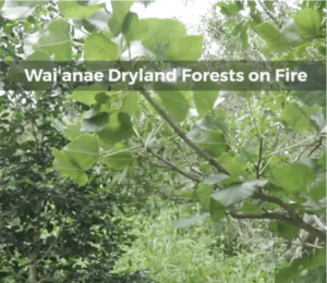
The native Hawaiian dryland forests of the Wai`anae Mountains are home to many unique species that are disappearing. Among the many threats facing dryland forests throughout the islands, the one that is perhaps most serious – and most preventable – is wildfire. (Produced by Outside Hawai’i, a program of Mālama Learning Center – 5 min)
Methodology of weed fire risk assessments. University of Hawai’i at Mānoa’s Kevin Faccenda and Curt Daehler developed a screening system focused on wildfire risk by asking land managers to assign a relative fire…
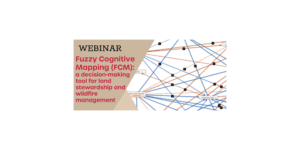
As Hawai‘i land managers know all too well, natural and cultural resource stewardship can be a daunting undertaking involving many stakeholders from different backgrounds taking into account complex social, cultural, and ecological considerations. In this webinar, UH Mānoa Masters student Rachael Cleveland demonstrates the utility of a decision support tool called Fuzzy Cognitive Mapping (FCM) which enables all stakeholders to create a “mental map” that can capture and compute the impacts of various decision-making scenarios on important resources. Land managers will learn how the FCM software works and its application to a wildfire group in Wai`anae, Hawai‘i whom she interviewed as part of her research.