Hawai‘i – old
History of Fire
Over the past decade, Hawai'i has experienced an average of >1,000 ignitions burning >20,000 acres (8,000 ha) each year across the main inhabited islands. Fire response agencies are able to contain 90% of wildfire ignitions to less than one acre in size, but large fires (>1000 acres) have occurred on all islands, and happen multiple times each year across the state.

Hawai‘i Fire History and Agricultural Decline (Credit: Trauernicht & HWMO)

Hawai‘i State Fires 1999-2022
Large Fire Perimeter Data for Hawai'i
This data set contains polygons of wildland fire perimeters for the main Hawaiian Islands from 1999 to 2022. It compiles prior mapping efforts by different organizations with fires mapped from 2012 onwards by Dr. Clay Trauernicht ([email protected]) in the Department of Natural Resources and Environmental Management (NREM) at the University of Hawai'i at Mānoa. The data tracks and maps all fires greater than or equal to 20 hectares (50 acres), but some smaller fires are be included.
NOTE ON DATA USE AND DISTRIBUTION: We actively encourage use of this data set for scientific purposes and planning by communities, natural resource managers, and emergency response agencies. Users are prohibited from any commercial, non-free resale, or redistribution without explicit written permission from Clay Trauernicht. Download Fire Perimeters HERE
Wildfire Threats and Impacts
Nearly all fires in Hawai'i are human-caused and they often pose threats to communities and natural and cultural resources. Having evolved in the absence of frequent fires, Hawai'i's native ecosystems are particularly vulnerable to fire disturbance, which is often associated with the spread and establishment of nonnative grass and shrub species.
Wildfire Drivers
The primary drivers of fire occurrence are: frequent, mostly human-caused ignitions; expansion of nonnative, fire-prone grasslands and shrublands over c. 25% of state land area; and strong rain shadow effects and episodic drought create which create year-round fire weather.
Maps, Images & Factsheets

Statewide Wildfire Ignitions (2016)

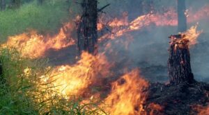
Palehua, O`ahu, Aug 2014 (Credit: Clay Trauernicht)

Recent Resources for the Western Pacific
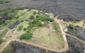
In the aftermath of evacuation and recovery, communities and responders are often dealing with hazardous environmental conditions which call for vigillant public safety and environmental stabilization.
The role that farms and ranches play in land care is critical across fire prone landscapes. Ranches and farms keep fire-prone weeds at bay to maintain pastures and crops.
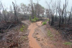
After human health and safety, the first priority is to protect the soils from rain and run-off.