Hawai‘i Island
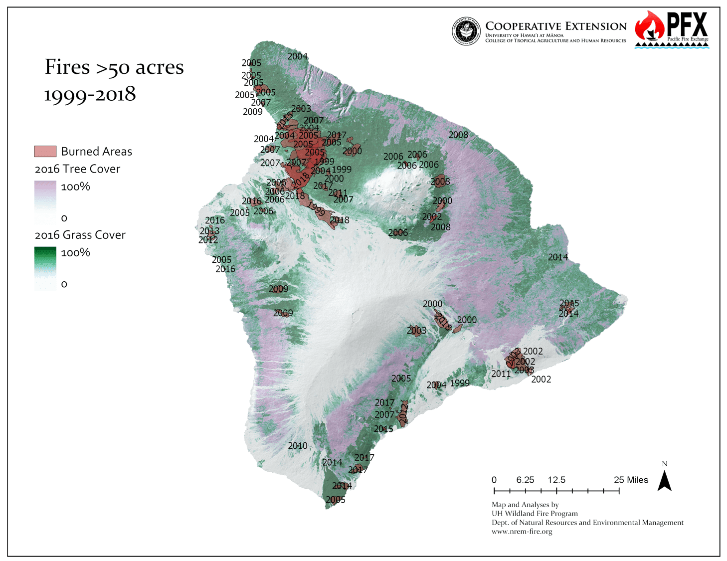
Hawaiʻi Island is unique in that it is the only Hawaiian island with ongoing active volcanic eruptions. However, humans are still by far the leading cause of wildfire ignitions. The majority of wildfires on Hawaiʻi Island are caused by human error or arson, especially near developments, power line right of ways, and along roadsides.
Fire Today
Rainfall follows the typical pattern of the Hawaiian Islands, with more rain along the eastern windward coast. Mauna Kea and Mauna Loa create a rain shadow that results in drier conditions on the western leeward coasts. Most of the former sugar plantation lands are on the wetter windward side of the island, along the Hāmākua Coast. Despite this location, there is a long history of fires in the area. It was the large 1901 Hāmākua coast fire that was the impetus for keeping wildfire records in Hawaiʻi. >> READ MORE
On the leeward side, the Kohala area is particularly fire-prone. This drier region with large areas of fallow pasture and agricultural land has a high rate of ignitions vis-a-vis human infrastructure, as well as more regular large fires.
The growing footprint of these grass-dominated fallow agricultural lands combined with increasing human population increases the risk of wildfire across the island. The hazardous vegetation and high number of ignitions is exacerbated by climate change creating more frequent drought conditions.
Seasonal variation in rainfall also affects both ignitions and the extent of areas which burn. Particularly wet periods over a rainy season can, counterintuitively, significantly elevate hazard levels. Increased precipitation may lead to a surplus of vegetation growth, becoming potential fuel during subsequent drier periods, thereby elevating the risk of large wildfires. Given the changing wind and rainfall patterns arising from climate change, this may lead to increased risk.
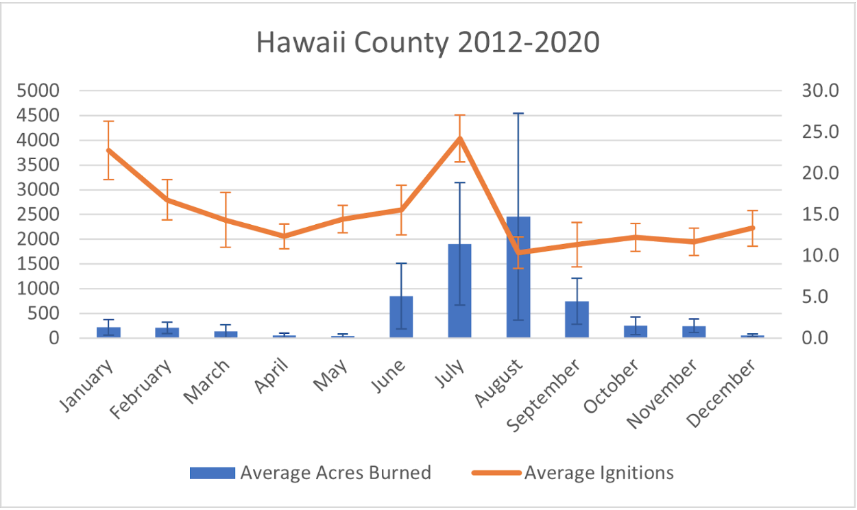
Hawai‘i Island Average Acres and Ignitions (2012-2020)
Recent Resources For Hawai‘i
Who: University of Hawaiʻi’s Kevin Faccenda and Dr. Clay Trauernicht Wildland Fire Specialist (UH Cooperative Extension) presented a hands-on webinar for land managers and land owners on the topic above.…
Tuesday, February 8, 2022 1:00 PM – 2:00 PM Who: Dr. Clay Trauernicht Wildland Fire Specialist (University of Hawaiʻi Cooperative Extension) will present on the topic above. What: As part of…
A Screening System to Predict Wildfire Risk of Invasive Plants (Biological Invasions, November 2021)
Download Paper Here Search Wildlife Risk Database Here Hawaii, Fire Ecology & Effects, invasive species, Tool Authors Kevin Faccenda and Curtis Daehler developed a screening system to identify introduced plant…

