Connecting Research to On-the-Ground Wildfire Priorities
PFX strives to serve the needs of wildfire practitioners, island communities and landscapes by working with our partners to identify and pursue relevant science and research across the Pacific region.
2014 Stakeholder Priorities
In 2014, wildfire stakeholders prioritized knowledge about pre-fire management; prevention, outreach, and education; wildland urban interface; after-fire response; wildfire suppression; collaboration; drivers and impacts of wildfire and the use of technologies. These priorities provided a road map for PFX products and activities and a resource to identify and develop research that meets on-the-ground needs (right). Read more here about these stakeholder priorities.
Current Wildfire Research Needs
PFX engages in many questions concerning the relationship of fire to the natural and built (human) environment. This include understanding how the climate crisis is impacting fire outcomes in the Pacific. In addition, building a better understanding of the social, cultural, economic and human dimensions of fire are critical Pacific Island research needs.
Do You Have a Great Idea You'd Like to Pursue?
Check Out Our Research Library


Recent Resources for Researchers
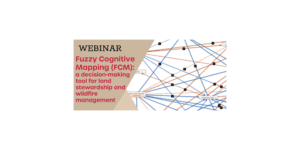
As Hawai‘i land managers know all too well, natural and cultural resource stewardship can be a daunting undertaking involving many stakeholders from different backgrounds taking into account complex social, cultural, and ecological considerations. In this webinar, UH Mānoa Masters student Rachael Cleveland demonstrates the utility of a decision support tool called Fuzzy Cognitive Mapping (FCM) which enables all stakeholders to create a “mental map” that can capture and compute the impacts of various decision-making scenarios on important resources. Land managers will learn how the FCM software works and its application to a wildfire group in Wai`anae, Hawai‘i whom she interviewed as part of her research.
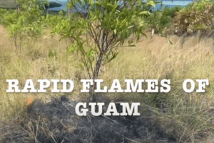
Learn about wildfire on Guam, the continuing threat it poses to people, native ecosystems, coral reefs and agriculture, and what you can do about it.
Tuesday, March 22, 2022 2:00 PM – 3:00 PM Who: University of Hawaiʻi’s Kevin Faccenda and Kelsey Brock will present “Identifying Fire-Promoting Invasive Plants & Their Potential to Impact Hawai‘i’s Natural…